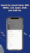
For maritime enthusiasts and professionals alike, ShipAtlas by Maritime Optima is an indispensable vessel tracking application. Leveraging real-time AIS data from a vast network of over 700 satellites and terrestrial sources, it offers unparalleled insights into global shipping activities. Track vessels, analyze trade patterns, monitor port operations, explore sea routes, and stay informed about marine weather, ice conditions, piracy risks, and more, all within a single, powerful app. ShipAtlas processes raw AIS data every second, ensuring the highest data quality and accuracy. Its intuitive interface allows for seamless searches by vessel name, IMO/MMSI numbers, or port details, including advanced filtering by LOA, beam, draft, and year built. Plan voyages efficiently with the integrated sea route calculator, estimating arrival times, distances, time at sea, and even projected fuel consumption. Create and manage unlimited custom vessel lists for continuous real-time monitoring. Enjoy convenient data synchronization across multiple devices and benefit from dedicated customer support.
Key Features of ShipAtlas:
-
Comprehensive Maritime Intelligence: Access detailed information on port activity, sea routes, weather conditions, ice formations, piracy hotspots, and detailed marine charts.
-
Superior Data Quality: Rigorous data processing ensures the accuracy and reliability of the AIS data presented.
-
Advanced Vessel Search: Efficiently locate vessels using various identifiers, including name, IMO/MMSI numbers, or port specifics. Refine searches using technical specifications (LOA, beam, draft, year built).
-
Sea Route Optimization: The built-in sea route calculator provides precise estimations of arrival times, distances (nautical miles), time at sea, and fuel consumption.
-
Dynamic Vessel Monitoring: Create an unlimited number of custom vessel lists and track their movements in real-time on the integrated map.
Verdict:
ShipAtlas by Maritime Optima is a highly intuitive and comprehensive application for real-time vessel tracking and maritime data analysis. Its user-friendly design, coupled with high-quality data and powerful features such as the sea route calculator, makes it an invaluable resource for anyone involved in or interested in the shipping industry. While many features are freely available, a paid subscription unlocks enhanced capabilities. Download ShipAtlas today and embark on a journey of maritime exploration and discovery. Learn more on our website.


 Application Description
  Apps like ShipAtlas by Maritime Optima


